“We do not believe any group of men adequate enough or wise enough to operate without scrutiny or without criticism. We know that the only way to avoid error is to detect it, that the only way to detect it is to be free to inquire. We know that in secrecy error undetected will flourish and subvert.” –J. Robert Oppenheimer
Nomadic Paleo-Indians traveled to Las Vegas 10,000 years ago, leaving behind petroglyphs. Anasazi and Paiute tribes followed at least 2,000 years ago.
A young Mexican scout named Rafael Rivera is credited as the first non-Native American to encounter the valley, in 1829.[17][18][19][20] Trader Antonio Armijo led a 60-man party along the Spanish Trail to Los Angeles, California in 1829.[21][22] The area was named Las Vegas, which is Spanish for “the meadows,” as it featured abundant wild grasses, as well as the desert spring waters needed by westward travelers.[23] The year 1844 marked the arrival of John C. Frémont, whose writings helped lure pioneers to the area. Downtown Las Vegas’s Fremont Street is named after him.
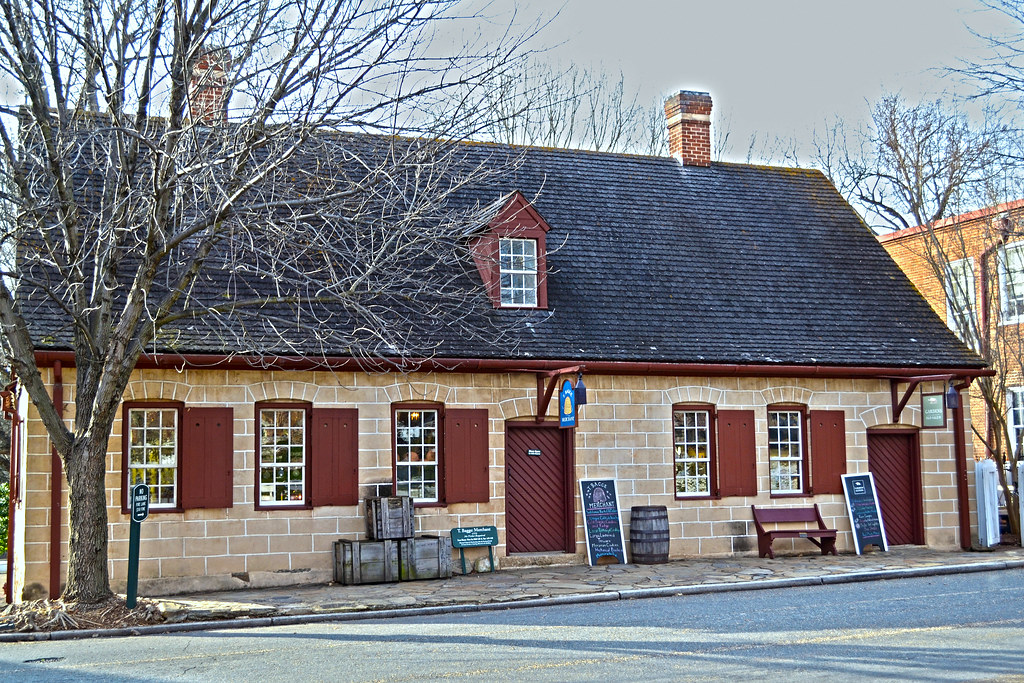
Eleven years later, members of The Church of Jesus Christ of Latter-day Saints chose Las Vegas as the site to build a fort halfway between Salt Lake City and Los Angeles, where they would travel to gather supplies. The fort was abandoned several years afterward. The remainder of this Old Mormon Fort can still be seen at the intersection of Las Vegas Boulevard and Washington Avenue.
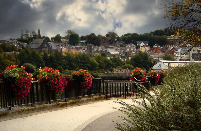
Las Vegas was founded as a city in 1905, when 110 acres (45 ha) of land adjacent to the Union Pacific Railroad tracks were auctioned in what would become the downtown area. In 1911, Las Vegas was incorporated as a city.[24]Golden Nugget and Pioneer Club along Fremont Street in 1952
1931 was a pivotal year for Las Vegas. At that time, Nevada legalized casino gambling and reduced residency requirements for divorce to six weeks. This year also witnessed the beginning of construction on nearby Hoover Dam. The influx of construction workers and their families helped Las Vegas avoid economic calamity during the Great Depression. The construction work was completed in 1935.
Following World War II, lavishly decorated hotels, gambling casinos, and big-name entertainment became synonymous with Las Vegas.This view of downtown Las Vegas shows a mushroom cloud in the background. Scenes such as this were typical during the 1950s. From 1951 to 1962, the government conducted 100 atmospheric tests at the nearby Nevada Test Site.[26]
In 1951, nuclear weapons testing began at the Nevada Test Site, 65 miles (105 km) northwest of Las Vegas. During this time, the city was nicknamed the “Atomic City”. Residents and visitors were able to witness the mushroom clouds (and were exposed to the fallout) until 1963, when the Partial Nuclear Test Ban Treaty required that nuclear tests be moved underground.[27][28]
In 1955, the Moulin Rouge Hotel opened and became the first racially integrated casino-hotel in Las Vegas.
As of this writing, on Friday, September 11, at about 1:30 in the afternoon Central Daylight Time, the finer details of President Donald Trump’s scheduled rally in Reno, Nevada, are not known, other than there is going to be one. Time and location are not available, so this is going to pop up in the morning and we can all meet here when it really happens.
Ever wonder how close this is to the truth?
So how did this desert gambling oasis pop up? A little history from wiki:
Archaeological finds place the eastern border for the prehistoric Martis people in the Reno area.[7] As early as the mid 1850s, a few pioneers settled in the Truckee Meadows, a relatively fertile valley through which the Truckee River made its way from Lake Tahoe to Pyramid Lake. In addition to subsistence farming, these early residents could pick up business from travelers along the California Trail, which followed the Truckee westward, before branching off towards Donner Lake, where the formidable obstacle of the Sierra Nevada began.
Gold was discovered in the vicinity of Virginia City in 1850, and a modest mining community developed, but the discovery of silver in 1859 at the Comstock Lode led to a mining rush, and thousands of emigrants left their homes, bound for the West, hoping to find a fortune.
To provide the necessary connection between Virginia City and the California Trail, Charles W. Fuller built a log toll bridge across the Truckee River in 1859. A small community that served travelers soon grew near the bridge. After two years, Fuller sold the bridge to Myron C. Lake, who continued to develop the community by adding a grist mill, kiln, and livery stable to the hotel and eating house. He renamed it “Lake’s Crossing”. Most of what is present-day western Nevada was formed as the Nevada Territory from part of Utah Territory in 1861.
By January 1863, the Central Pacific Railroad (CPRR) had begun laying tracks east from Sacramento, California, eventually connecting with the Union Pacific Railroad at Promontory, Utah, to form the First Transcontinental Railroad. Lake deeded land to the CPRR in exchange for its promise to build a depot at Lake’s Crossing. In 1864, Washoe County was consolidated with Roop County, and Lake’s Crossing became the county’s largest town. Lake had earned himself the title “founder of Reno”.[8] Once the railroad station was established, the town of Reno officially came into being on May 9, 1868.[9] CPRR construction superintendent Charles Crocker named the community after Major General Jesse Lee Reno, a Union officer killed in the Civil War at the Battle of South Mountain.
In 1871, Reno became the county seat of the newly expanded Washoe County, replacing the county seat in Washoe City. However, political power in Nevada remained with the mining communities, first Virginia City and later Tonopah and Goldfield.[2][10]
The extension of the Virginia and Truckee Railroad to Reno in 1872 provided a boost to the new city’s economy. In the following decades, Reno continued to grow and prosper as a business and agricultural center and became the principal settlement on the transcontinental railroad between Sacramento and Salt Lake City.[11] As the mining boom waned early in the 20th century, Nevada’s centers of political and business activity shifted to the nonmining communities, especially Reno and Las Vegas, and today, the former mining metropoles stand as little more than ghost towns. Despite this, Nevada is still the third-largest gold producer in the world, after South Africa and Australia; the state yielded 6.9% of the world’s supply in 2005 world gold production.[12]
Gold, huh. No wonder the Democrats are hanging on to Nevada for dear life.
Reno took a leap when the state of Nevada legalized open gambling on March 19, 1931, along with the passage of even more liberal divorce laws than places such as Hot Springs, Arkansas, offered. No other state offered what Nevada had in the 1930s, and casinos such as the Bank Club and Palace were popular.[citation needed] The new Nevada divorce laws, passed around 1927, allowed people to divorce after six weeks of residency instead of six months. People wishing to divorce stayed in hotels, houses, and/or dude ranches. Most divorcees left Nevada when their divorces were finalized, while some stayed.[14]
Within a few years, the Bank Club, owned by George Wingfield, Bill Graham, and Jim McKay, was the state’s largest employer and the largest casino in the world. Wingfield owned most of the buildings in town that housed gaming and took a percentage of the profits, along with his rent.[15]
Ernie Pyle once wrote in one of his columns, “All the people you saw on the streets in Reno were obviously there to get divorces.” In Ayn Rand‘s novel The Fountainhead, published in 1943, the New York-based female protagonist tells a friend, “I am going to Reno,” which is taken as a different way of saying “I am going to divorce my husband.” Among others, Belgian-French writer Georges Simenon, at the time living in the U.S., came to Reno in 1950 to divorce his first wife.[16]
Truthfully, the closest this writer has ever been to Reno is probably Tahoe/State Line, Nevada, which was also the last and only casino she ever patronized. The place gave me a headache.
UPDATE: The rally will be at Minden-Tahoe Airport, about 40 miles away from Reno. So, here’s some Tahoe info:
The lake was formed about two million years ago as part of the Lake Tahoe Basin, with the modern extent being shaped during the ice ages. It is known for the clarity of its water and the panorama of surrounding mountains on all sides.[5] The area surrounding the lake is also referred to as Lake Tahoe, or simply Tahoe. More than 75% of the lake’s watershed is national forest land, being the Lake Tahoe Basin Management Unit of the United States Forest Service.
Lake Tahoe is a major tourist attraction in both Nevada and California. It is home to winter sports, summer outdoor recreation, and scenery enjoyed throughout the year. Snow and ski resorts are a significant part of the area’s economy and reputation.[6][7] The Nevada side also offers several lakeside casino resorts, with highways providing year-round access to the entire area.
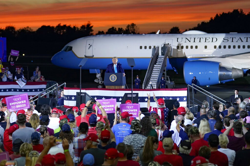
Trump is scheduled to speak at 7 p.m. from Avflight Saginaw, an aviation company located at the MBS International Airport in Freeland. Thursday’s event is the president’s first campaign rally in the state this year, coming while polls show the race tightening in Michigan.
So, just where is Freeland? If Michigan is a mitten, it’s between the thumb and index finger on the fleshy part.
The place was home to Native Americans long before the arrival of settlers of European ancestry. In the 1819 Treaty of Saginaw, in which the Chippewa, Ottawa, and Pottawatomi ceded a large portion of land including Saginaw County to the United States federal government. In that treaty, within the ceded territory, several tracts were reserved for specific groups of Chippewa. One such tract, Black Bird’s Village, consisted of 6,000 acres (24 km2) on the Tittabawassee (named as the Tetabawasink river in the text of the treaty), very near to the present location of Freeland.[5] [6] [7]
In the 1850s, lumbering outposts developed in the area, one of which was called “Loretta”, which was given a post office named “Jay” in April 1856. The office was named for the first postmaster, Jefferson Jaqruth. This outpost was very nearly at the geographical center of Tittawabasse Township. Another settlement was placed just a little to the north. in 1867, one resident of the second locale, George Truesdale, instigated moving the post office from Loretta to his settlement, which retained the name of Jay for several years afterwards.
The name of Freeland comes from “Mammy Freeland” who operated a popular tavern on the river, frequented by lumbermen and rivermen, who came to refer to the entire settlement as Freeland. The name of the post office was changed to Freeland in January 1879. It was also a station on the Pere Marquette Railroad. By another account (Moore), the Freeland family name was prominent in business and politics of the area.
During World War II, the airport was used to hold German prisoners of war.
That last bit could be useful at some trivia night.
No mention of hockey, though. Shows who is updating the wiki pages. I mean, this description screams “WORKING CLASS SMALL TOWN” in the most basic and stark of terms. This is about the most picturesque photo I can find of the place in the midst of old houses and McMansions for sale. Talk about being unpretentious.
From Freeland earlier:
I’ll add live links to this post during the late afternoon as they become available.
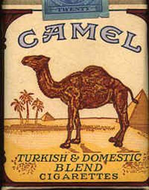
Winston-Salem is called the “Twin City” for its dual heritage. “Camel City” is a reference to the city’s historic involvement in the tobacco industry related to locally based R. J. Reynolds Tobacco Company’s Camel cigarettes. Many locals refer to the city as “Winston” in informal speech. Winston-Salem is also home to many colleges and institutions, most notably Wake Forest University and Winston-Salem State University.
Camels a day early, let’s see….
The last time I saw somebody with a pack of these, I was in Italy.
Just like so many places in the historic south, the housing was built high to avoid the fumes from the horse droppings.
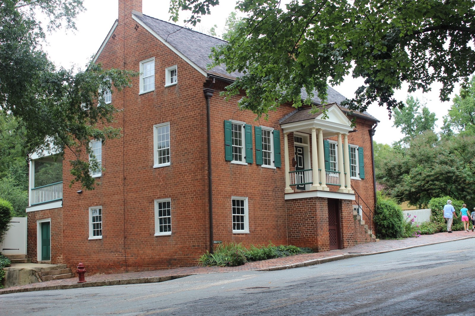
Salem The origin of the town of Salem dates to January 1753, when Bishop August Gottlieb Spangenberg, on behalf of the Moravian Church, selected a settlement site in the three forks of Muddy Creek. He called this area “die Wachau” (Latin form: Wachovia) named after the ancestral estate of Count Nicolaus Ludwig von Zinzendorf. The land, just short of 99,000 acres (400 km2), was subsequently purchased from John Carteret, 2nd Earl Granville.
On November 17, 1753, the first settlers arrived at what would later become the town of Bethabara. This town, despite its rapid growth, was not designed to be the primary settlement on the tract. Some residents expanded to a nearby settlement called Bethania in 1759. Finally, lots were drawn to select among suitable sites for the location of a new town.
The town established on the chosen site was given the name of Salem (from “Shalom” meaning “Peace”, after the Canaanite city mentioned in the Book of Genesis) chosen for it by the Moravians’ late patron, Count Zinzendorf. On January 6, 1766, the first tree was felled for the building of Salem. Salem was a typical Moravian settlement congregation with the public buildings of the congregation grouped around a central square, today Salem Square. These included the church, a Brethren’s House and a Sisters’ House for the unmarried members of the Congregation, which owned all the property in town. For many years only members of the Moravian Church were permitted to live in the settlement. This practice had ended by the American Civil War. Many of the original buildings in the settlement have been restored or rebuilt and are now part of Old Salem Museums & Gardens.[8]
Salem was incorporated as a town in December 1856.[9] Salem Square and “God’s Acre”, the Moravian Graveyard, since 1772 are the site each Easter morning of the world-famous Moravian sunrise service. This service, sponsored by all the Moravian church parishes in the city, attracts thousands of worshipers each year.[10]
Winston In 1849, the Salem congregation sold land north of Salem to the newly formed Forsyth County for a county seat. The new town was called “the county town” or Salem until 1851 when it was renamed Winston for a local hero of the Revolutionary War, Joseph Winston.[11] For its first two decades, Winston was a sleepy county town. In 1868, work began by Salem and Winston business leaders to connect the town to the North Carolina Railroad.[12] That same year, Thomas Jethro Brown of Davie County rented a former livery stable and established the first tobacco warehouse in Winston. That same year, Pleasant Henderson Hanes, also of Davie, built his first tobacco factory a few feet from Brown’s warehouse. In 1875, Richard Joshua Reynolds, of Patrick County, Virginia, built his first tobacco factory a few hundred feet from Hanes’s factory. By the 1880s, there were almost 40 tobacco factories in the town of Winston. Hanes and Reynolds would compete fiercely for the next 25 years, each absorbing a number of the smaller manufacturers, until Hanes sold out to Reynolds in 1900 to begin a second career in textiles.
So, Winston-Salem actually started life as two different cities and was combined by the post office, actually, in 1880
In the 1880s, the US Post Office began referring to the two towns as Winston-Salem. In 1899, after nearly a decade of contention, the United States Post Office Department established the Winston-Salem post office in Winston, with the former Salem office serving as a branch. After a referendum the towns were officially incorporated as “Winston-Salem” in 1913.
The Reynolds family, namesake of the R. J. Reynolds Tobacco Company, played a large role in the history and public life of Winston-Salem. By the 1940s, 60% of Winston-Salem workers worked either for Reynolds or in the Hanes textile factories.[13] The Reynolds company imported so much French cigarette paper and Turkish tobacco for Camel cigarettes that Winston-Salem was designated by the United States federal government as an official port of entry for the United States, despite the city being 200 miles (320 km) inland.[13] Winston-Salem was the eighth-largest port of entry in the United States by 1916.[13]
In 1917, the Reynolds company bought 84 acres (340,000 m2) of property in Winston-Salem and built 180 houses that it sold at cost to workers, to form a development called “Reynoldstown.”[13] By the time R.J. Reynolds died in 1918, his company owned 121 buildings in Winston-Salem.[13]
I’ll add live links to this post during the late afternoon as they become available.
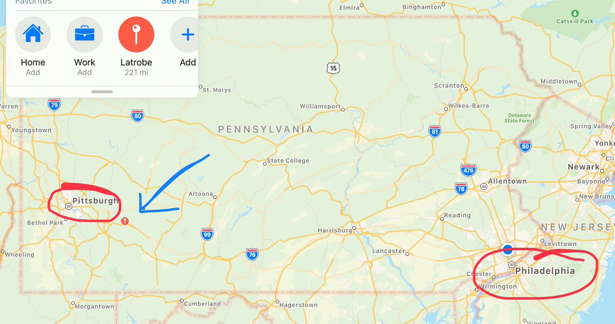
For his second rally of the 2020 Presidential Campaign re-start, President Donald J. Trump and his team have chosen to stick to small town America, and have chosen…Latrobe, Pennsylvania?
Uhh, where is this place? (Thanks to an anon @Jack’s place, we have a map.)
More to the point, tonight’s rally is in a swing state where the officials have been known to play the precinct waiting game on election night.
Looks like the savvy 4D chess player is going to try to head that off at the pass.
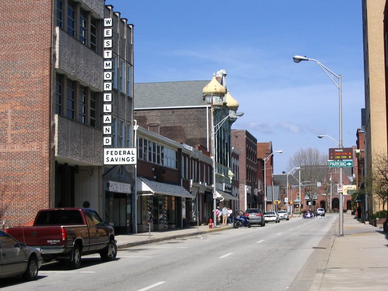
Main Street, Latrobe, Pennsylvania
So, aside from being in what appears to be the fabled steel country of western Pennsylvania, what info is there out there on Latrobe? From wiki:
In 1852, Oliver Barnes (a civil engineer for the Pennsylvania Railroad) laid out the plans for the community that was incorporated in 1854 as the Borough of Latrobe. Barnes named the town for his best friend and college classmate, Benjamin Latrobe, who was a civil engineer for the B&O Railroad. (His father, Benjamin Henry Latrobe, was the architect who rebuilt the United States Capitol in Washington, DC, after the War of 1812.)
Its location along the route of the Pennsylvania Railroad helped Latrobe develop into a significant industrial hub. Latrobe was also served by the Ligonier Valley Railroad from 1877 to 1952.
In 1904, the banana split was invented in Latrobe by David Evans Strickler at the pharmacy that later became named Strickler’s Drug Store.[4]
Two interurban (long-distance trolley) lines served Latrobe:
The Westmoreland County Railway Company connected Latrobe to Derry and operated from 1904 to 1932.[5] The Latrobe Street Railway Company connected Latrobe to Kingston and began operations in 1900.[6] This line was purchased by West Penn Railways, which eventually linked it with its network running through Youngstown, Pleasant Unity, and eventually to Greensburg and Uniontown. Service ceased in 1952.[6] Latrobe has two sites on the National Register of Historic Places within its city boundaries:
Pennsylvania Railroad Station at Latrobe (325 McKinley Avenue): This station was built by the Pennsylvania Railroad in 1903.[7] Citizens National Bank of Latrobe (816 Ligonier Street, at Main Street): This was previously known as the Mellon Bank Building. This six-story, 1926 structure was designed by the Greensburg firm of Batholomew and Smith.[8] The former Fort Sloan, a small fortress established by the British settlers in the 1700s, is now a private residence, situated on the corner of Cedar St. and Raymond Ave.
So, it’s a rail town. Got it.
And has become standard operating procedure with these rallies, the crowds started turning up early.
“I’m not kidding, I truly believe that Donald Trump was sent by God." Supporters of President Trump were seen camping out at Arnold Palmer Regional Airport ahead of his rally tonight in Latrobe. https://t.co/TaZiKB2jNBpic.twitter.com/0XeHD2eDfd
Edward Young drove six hours, 340 miles from Brick New Jersey to Latrobe to attend the President's rally Thursday evening as @KatelynsWTAE reports #WTAEhttps://t.co/2LWqUGyMXl
Author note: I dusted this off from the postponed rally in July. Please, let me know if there are obvious errors. I’ll fix ’em.
Riding the momentum of the finale of the Republican National Convention last night, our VSGPOTUSDJT will be heading back out on the campaign trail. He’ll do his part, and it’s up to us to do ours.
Okay, America, a repeat of this is the goal:
Oh, my gosh, were they wrong.
Well, with the exception of the absence of Chris Mathews…yeah, they’re setting themselves up for big time disappointment again using polls that just don’t match the empirical evidence in the size and enthusiasm of the crowds the president is drawing, as well as the ones Joe Biden is not.
Oh, well.
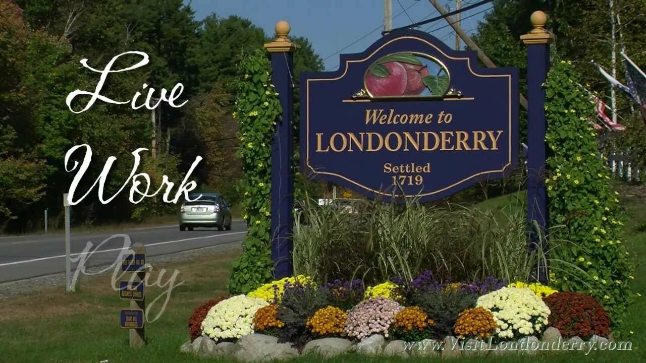
Tonight’s rally in Londonderry, New Hampshire at 6 pm eastern daylight time is sure to have vibes nothing like the mourning the mainstream media was experiencing in November of 2016 after the polls turned out to be wrong on a collosal scale.
Let’s make them wrong again, and starting in the state, one of the original thirteen, where the motto is “Live Free or Die.”
Looks perfectly idyllic doesn’t it?
I suspect that my one and only time in New Hampshire – during a marathon camping trip to New England while on an interstate between Glouchester, Mass., and Freeport, Maine, so that my mother could actually say she had been to L.L.Bean – we probably passed this town which looks to be a classic Americana kind of place with some colonial roots. From wiki:
Londonderry lies in an area that was first known as Nutfield because of the dense woods with nut trees. A petition for the town was submitted to the General Court of the Province of New Hampshire on September 23, 1719.[5] That petition stated that the petitioners had settled “at Nutfield about the Eleventh of Aprile last” – i.e. April 11, 1719. That petition requested “ten miles square” and stated that there were now about seventy families and inhabitants from both Ireland and New England. Many of the Scots-Irish settlers had left their homes in Londonderry in the Province of Ulster in the north of Ireland, and arrived in Boston in 1718 to start a new life without religious wars and persecution. On June 21, 1722, the town was chartered and given the name “Londonderry”.[6][7][8] The grant made by Samuel Shute, Governor of the Province of New Hampshire, was for a tract of land described as follows:
“Beginning on the North East Angle at a Beach Tree marked which is the south East angle of Chester and Running from thence due South on Kingstown Line four miles and an half and from thence on a West Line one mile and three Quarters and from thence South six miles and an half and from thence West north West nine miles and an half, and from thence North Eleven miles and an half from thence north north East Three miles from thence East South East one mile and from thence South South West to the South West Angle of Chester and from thence on an East Line Bounding on Chester Ten miles unto the Beach Tree first mentioned.”
And for those who have heard the word “Londonderry” before, but can’t place it, here’s some mood music.
Several sets of text have been put to this music, but, yes, it’s best known as “Danny Boy.”
I’ll add live links to this post during the late afternoon as they become available.


